|
Marty Quaas' Photo Tour of the Pacific Electric and Santa Fe in Corona, CA Sunday, May 31, 1964 Copyright 2009 by James E. Lancaster, Ph.D. Page
created February 14, 2009 All photos are by Marty Quaas and are Copyright 2009. They may not be used for any purpose without the permission of the photographer. Photo Gallery
Marty wrote the following about the day he spent in Corona and about his photos: "On May 31,
1964 I had left the family at the City Park to play on the
swings and I set-out to walk the Pacific Electric route which was on
3rd Street. I
think that I got on the PE tracks at Grand and then proceeded to go
west on 3rd.
"At Merrill, the tracks turned to the north, crossed Grand, and went under the freeway where there was a run-around track. As I remember, even though the PE and Santa Fe tracks were only a few feet apart at the end of the PE line, there was no connection and it looked like there never was. This was the end of Huntington's dream connection with Yorba Linda. "I then proceeded east along the Santa Fe and took several more pictures - the sand car, the depot, the GP9, the shanties, and then the scale house. I then think that I went south back toward the City Park where I got pictures of two oil companies off the east end of 3rd St." 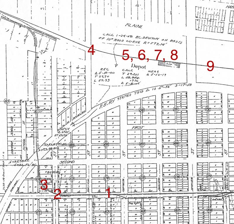 Pacific
Electric map of northwest Corona showing locations of Marty Quaas'
photos.
(Map from Cliff Prather collection) 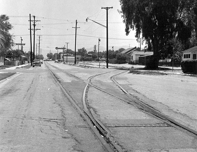 Photo 1.
This view is looking east along Third Street. The nearest cross street
is Belle Avenue. The car crossing Third Avenue in the distance is on
Main Street. The Standard service station is at Third and Main. The
PE's Corona depot was previously located on the site of the service
station. It was torn down in 1961. For photos of the PE depot, click here (a new window will
open).
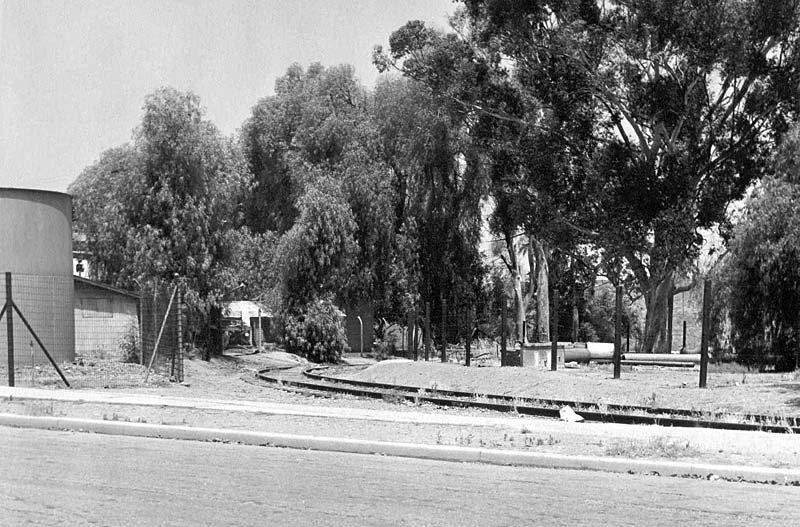 Photo 2.
This view is looking northwest from Third Street where the PE track
turned to go north to the W. H. Jameson packing house. According to the
most recent Sanborn map for this area (dated 1942), the Corona Foothill
Lemon Co. operated a pump plant just west of the curving track (left
side of the photo). The tank that's half visible was an oil tank. The
building behind it was for pipe storage. One of the pump plant
buildings that is out of view in the photo is still standing on Grand
Ave.
Robert Gaddie provided the following description of the pump plant: "Water was
pumped from this point several miles south into reservoirs at the base
of the mountains. From these reservoirs the water flowed by
gravity through canals and pipelines to the orchards.
"I was in the pumping plant a few times with my Dad when I was a kid. My Dad said the pumps were originally powered by steam engines. The engines powered large wheels. The wheels were so large that pits were dug into the floor. Half of the wheel was down in the pit. These large wheels powered a belt that went to a smaller wheel. The small wheel powered a shaft that powered the pump. By the time I have any memory of the pumping plant the steam engines had been replaced by electric motors that powered the pump shafts directly. "The pits for the large wheels were still in the building when I was in there. I can remember looking down into them and thinking they were very deep. But for a kid everything looks larger than it is. "The tank at the left in the May 1964 photo was probably for fuel oil for the steam engines. In the Corona PE depot was a blueprint map of the PE tracks in Corona. It was made during the 1920's. ... The map showed a short spur into the pumping plant property. I assume this spur was for the delivery of tank cars of fuel for the steam engines. "There was also a house on the pumping plant property. A Foothill employee lived in the house. He operated the pumps."  Photo 3.
This
view is looking almost north to where the PE track went under the
Riverside Freeway (SR 91). Just beyond the freeway was a siding used as
a runaround track. At the very end of the PE's Corona line, the track
curved toward the west and paralleled the Santa Fe's Third District
main line. Both the PE and the Santa Fe had spurs serving the W. H.
Jameson packing house but there was no connection between the two. For
a view of the spurs and the packing house, click here and scroll down to the
Bob Gaddie photo (a new window will open).

Photo 4. This photo
shows the Corona Citrus Association packing house. The wigwag is on N.
Sheridan St. For additional photos of Corona
Citrus Association, click here and look at Figures 5-7
(a
new window will open).
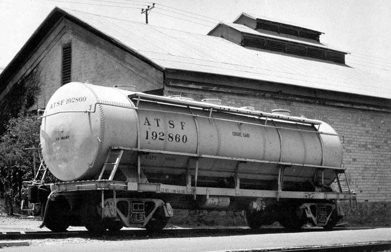 Photo 5.
This car labled "ENGINE SAND" was just west of the Santa Fe's Corona
depot. The building behind the car was at one time a packing house that
operated under several names: Corona Packing Company, Randolph Fruit
Company, Riverside County Select Groves and Corona Mutual Groves.
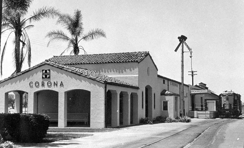 Photo 6.
This photo was taken from the east end of the Corona depot. Geep 709
and a caboose are in front of the freight end of the depot. Beyond the
depot is the packing house shown in Photo 5.
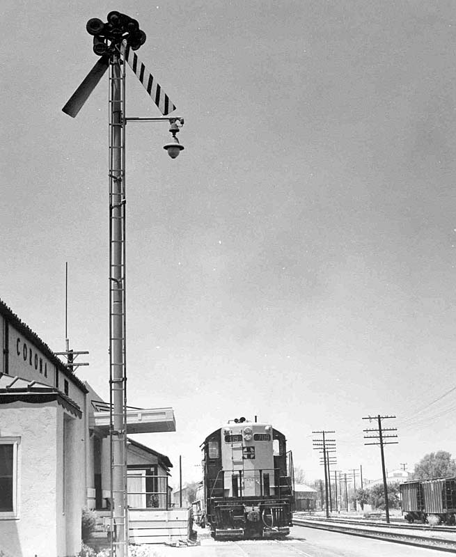 Photo 7.
This
photo is looking west. To the left of Geep 709 is the corner of the
packing
house shown in Photo 5. To the right and further down the Third
District main line toward Fullerton, a reefer is spotted at the Jameson
packing house. Further to the right is the arched roof of the Corona
Citrus Association packing house. For similar views from this location,
click here and look at Figures 8
and 9 (a new
window will open).
 Photo 8. A closer
look at GP9 709.
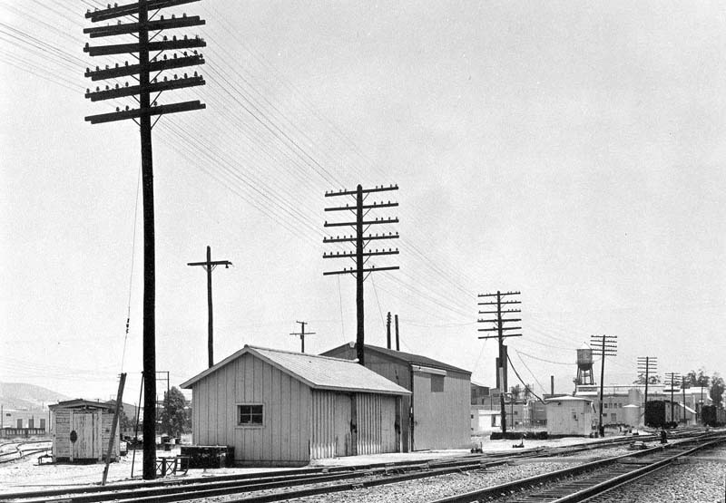 Photo 9.
This photo is looking east from a location about 1/2 block east of the
depot. The buildings in the distance (with the water tower) are part of
the Exchange Lemon Products facility. The track curving off at the far
left went behind part of the
Exchange Lemon buildings. For more photos of Exchange
Lemon Products, click here and look at Figures
18-23 (a new
window will open).
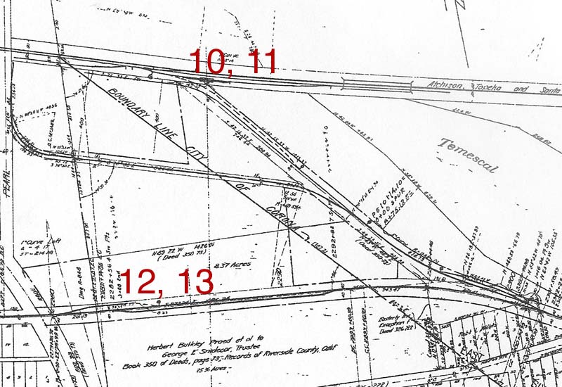 Pacific Electric map of northeast Corona showing locations of Marty Quaas' photos. (Map from Cliff Prather collection) 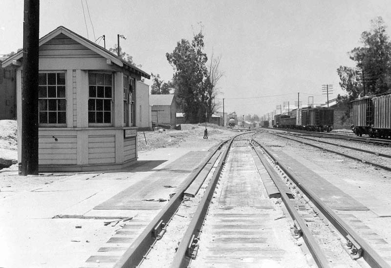 Photo 10.
This photo is looking west toward the depot area. The Jameson packing
house is visible at the far end of the tracks. Exchange Lemon
Products is on the right beyond the string of freight cars with the
gondolas. The scale house is on the left and the scale track is in the
center of the photo.
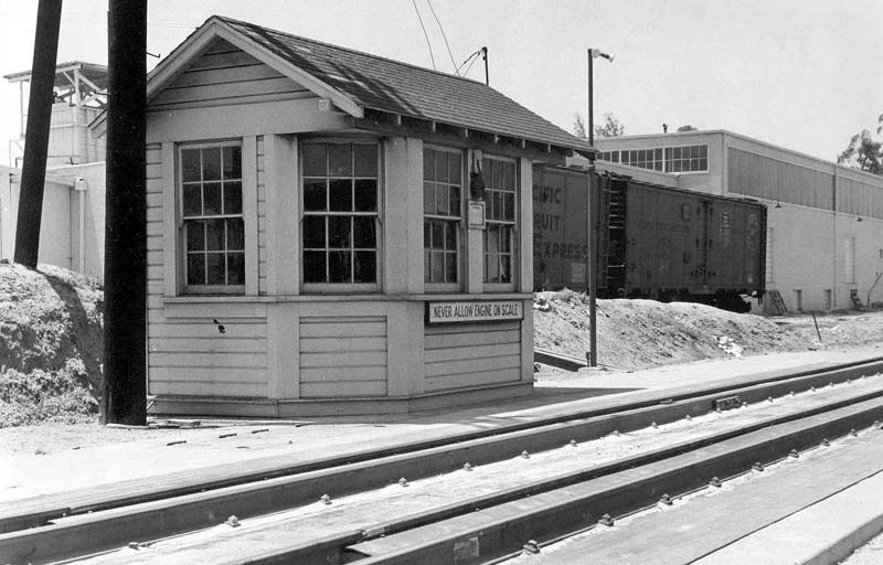 Photo 11.
The scale house has a sign on the front that reads "NEVER ALLOW ENGINE
ON SCALE." The building in the rear is the Orange Heights Orange
Association packing house. It was served by the PE, which is why PFE
reefers are spotted at the packing house. For more photos of the Orange
Heights Orange Association packing house and the scale house, click here and look at Figures 26
and 27, as well as Figures 35-38 (a new
window will open).
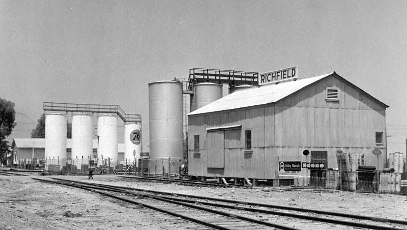 Photo 12.
Marty's last stop that day was back on the PE, just east of the
intersection of Third Street and Grand Avenue, to photograph these two
bulk oil dealers. The
trees on the far left were close to Grand Ave.
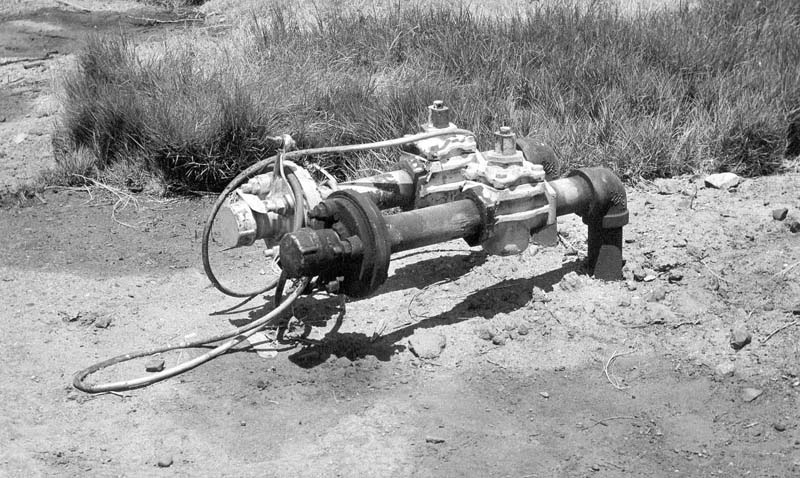 Photo 13. The final
photo is a closeup showing the connectors used to connect
a tank car to the oil dealers.
Return to the Trains Page. |