|
Layout Photos June 2010 Copyright 2010 by James E. Lancaster This gallery of
photos shows progress to date on creating a 1950s-era version of
the town of Highgrove, CA on the upper deck of my HO scale model
railroad.
Highgrove was served by the Santa Fe, Union Pacific and Southern Pacific railroads. The Santa Fe, and its tenant Union Pacific, had a double track, north-south main line through the western part of the town. The Santa Fe line to Hemet and San Jacinto branched of the mainline in Highgrove. Sanborn fire insurance maps show a depot, a nameless fruit packing house, a fertilzer warehouse, a Riverside county road department yard and a Shell oil dealer along the Santa Fe-Union Pacific tracks. 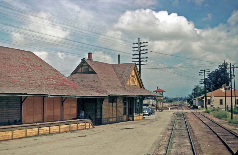 Figure 1. I believe this photo was taken by
Jack Whitmeyer, ca. 1950. The view looks north toward Colton and San
Bernardino. The left hand track in the foreground is the Santa Fe's San
Jacinto Branch. The Santa Fe-Union Pacific mainline to Riverside curves
to the left in the distance and passes on the opposite side of
the depot. The crossing watchman's tower is at Center St. Just beyond
Center St. on the rght is a fruit packing house and beyond that a
fertilizer warehouse (barely visible).
 The SP branch line from Colton to Riverside (known as the Riverside Branch) came through Highgrove about two blocks east of the Santa Fe-Union Pacific tracks. The Sanborn fire insurance map shows a depot, Highgrove Fruit Association packing house and nameless fertilzer warehouse along the tracks. A second packing house, L.V.W. Brown Estates, was east of the Highgrove Fruit Association. Modeling Highgrove
Figure
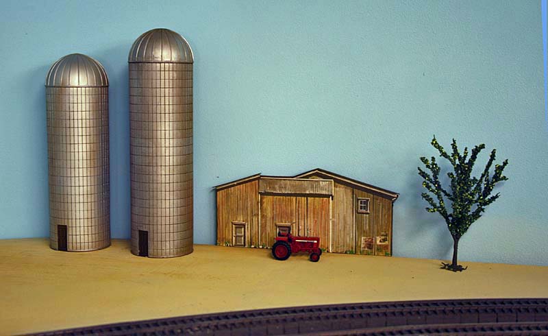
15. There is some open space at the south end of Highgrove (to the left
in Figure 3). I may put a small farm there, somewhat like what is shown
here. The silos are from Imex.Photo Date: June 23, 2010
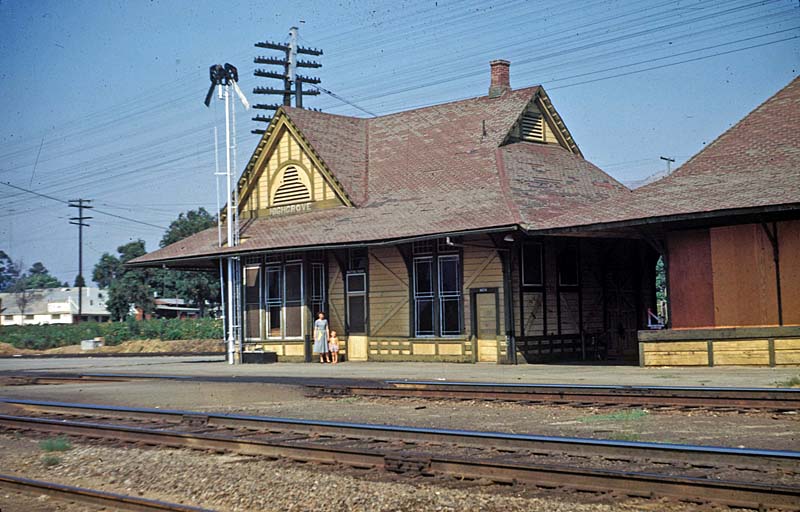
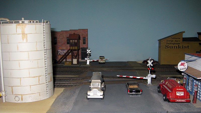
My version of Highgrove has the double track Santa Fe-Union Pacific mainline with with one spur and the single track SP Riverside Branch with two spurs. Whereas in reality the two lines are over two blocks apart, on my 20" wide upper deck the two lines are relatively close. 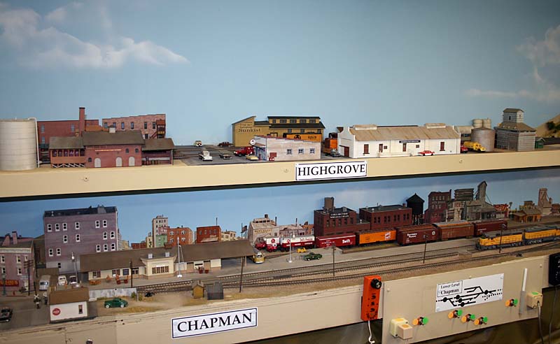 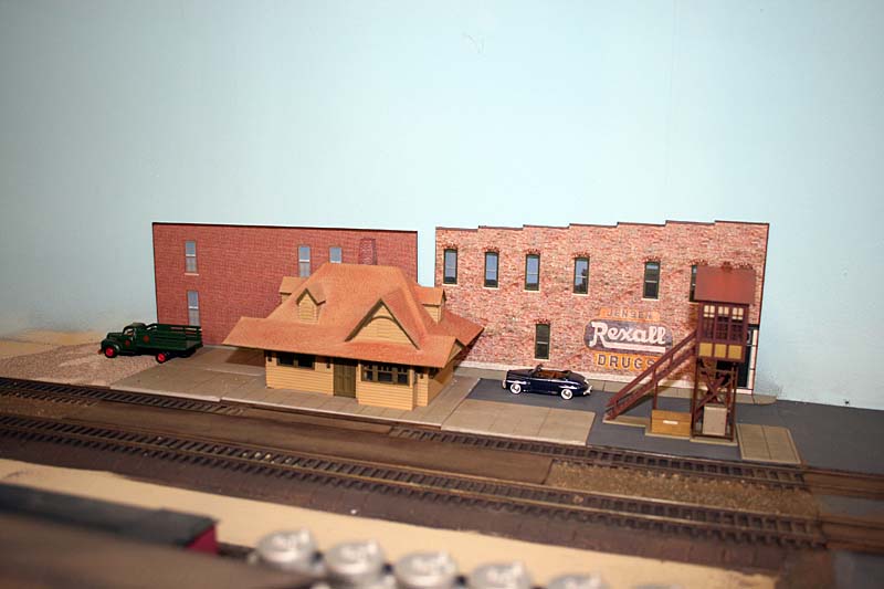 Figure 4. This
photo shows the Santa Fe depot. It's an old Atlas depot I had in a
trash box. I boarded over some windows and repainted it giving it
somewhat the look of the depot in Figure 2. The crossing tower is a
Walthers model. The background flats are sides of HO scale paper buildings available on the internet.
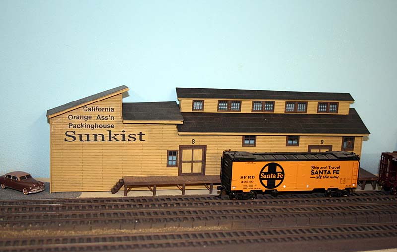 Figure
5. The prototype packing house on the Santa Fe was on the east
side of the tracks (Figure 1). Because of space limitations mine is on
the west side. This is a Showcase Miniatures model built by Bill Messecar.
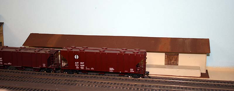 Figure 6. The fertilizer warehouse is just a mock-up for now. The
prototype warehouse was on the east side of the
tracks but mine is on the west
side.
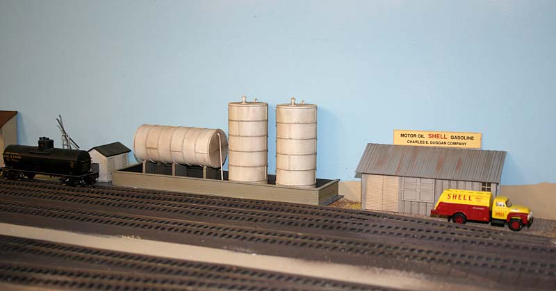 Figure
7. The Charles E. Duggan Company is the name of the Shell dealer on the
Sanborn map. The model is a kit-bashed Walthers bulk oil dealer
modified to fit the narrow location.
 Figure
8. The San Gorgonio Coop Winery is on the SP but is a ficticious
industry. I needed a winery to fill all my Chateau Martin wine cars! I
bought this structure at a swap meet for a dollar. The tank is from a
Kibri kit (I think).
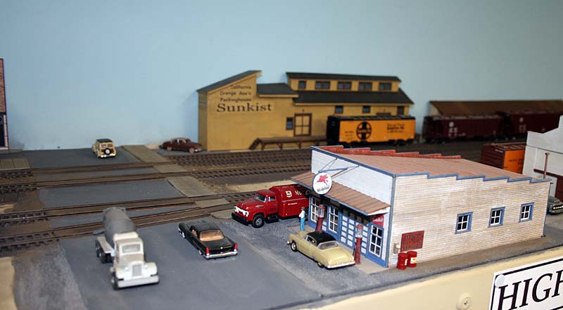 Figure 9. A Mobil gas station-garage was not in this location next to the SP Riverside Branch where it crosses Center St. But it's an ideal spot to show off the model scratchbuilt by Kevin Barnett.
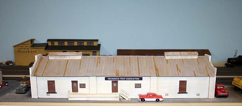 Figure 10. The Highgrove Fruit Association packing house was built from a CC Crow plaster kit.
 Figure
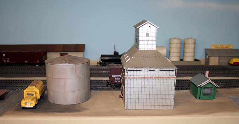
11. At this location on the prototype SP there was a fertilizer
warehouse. I put in a smudge oil tank and a small grain elevator
instead. The tank is from a Rix Products kit from Walthers and the
grain elevator is from Athearn. Figure
11. At this location on the prototype SP there was a fertilizer
warehouse. I put in a smudge oil tank and a small grain elevator
instead. The tank is from a Rix Products kit from Walthers and the
grain elevator is from Athearn. 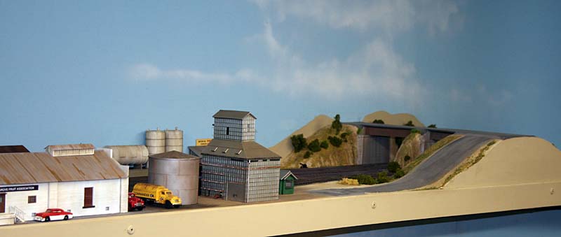 Figure 12. Barton Road crosses both the Santa Fe-Union Pacific mainline and the SP Riverside Branch between Highgrove and Colton. I included my version of Barton Road as shown on the right of this photo.
You can view September 2009 photos of Barton Road and the railroads passing under it by clicking on any of the following: Photo a. Barton Road looking west from the bridge over the SP Riverside Branch Photo b. Looking south from the bridge over the Santa Fe-Union Pacific mainline. Photo c. Looking north from the bridge over the Santa Fe-Union Pacific mainline. Photo d. Looking south from the bridge over the SP Riverside Branch. Photo e. Looking north from the bridge over the SP Riverside Branch. The bridge over the Santa Fe-Union Pacific tracks is dated 1936. The bridge over the SP is of unknown age so I'm not sure of the date of the fill leading to the bridge (Photo a.). I'm assuming the bridge and fill were there in the 1950s. 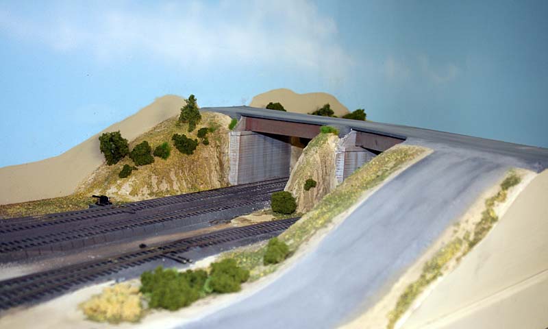 Figure
13. This is a closer view of the south side of the Barton Road fill and
bridges. The bridges still need their railings (I'm waiting for
some from Walthers). I added some connecting pavement that goes down to
the grain elevator (albeit on a rather steep grade).
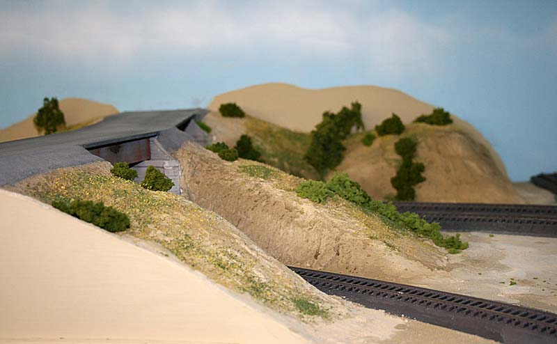 Figure 14. This is the north side of the Barton Road fill.
 Photos Added: June 26, 2010 Barton Road and Highgrove 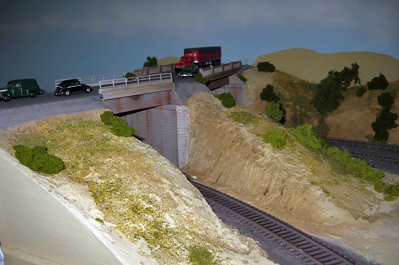 Figure 16. Similar to Figure 14 but with bridge railings in place.
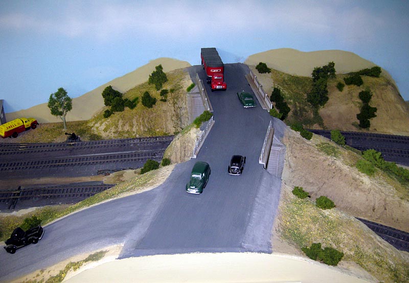 Figure 17. Overhead view of Barton Road.
 Figure
18. Center Street in Highgrove with crossing gates in place. A similar
gate is visible in Figure 1. They were operated by the crossing
watchman in the tower. The prototype gates only protected the tracks of
the Santa Fe Third District mainlaine and the San Jacinto Branch but on
the layout they also protect the tracks of the SP Riverside Branch.
 Figure
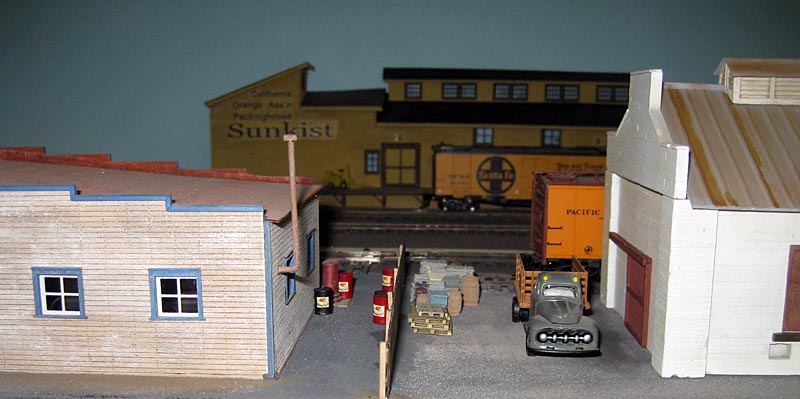
19. Details add a lot of interest between the back of the Mobil gas
station (left) and the end of the Highgrove Citrus Association packing
house.
Other Recent Changes  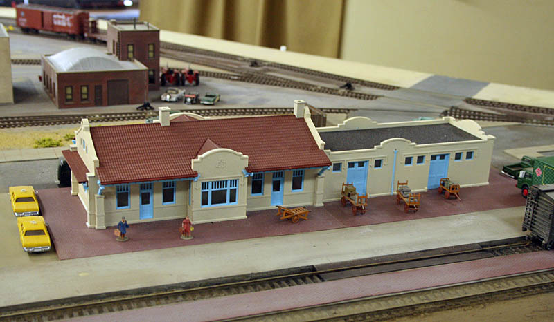 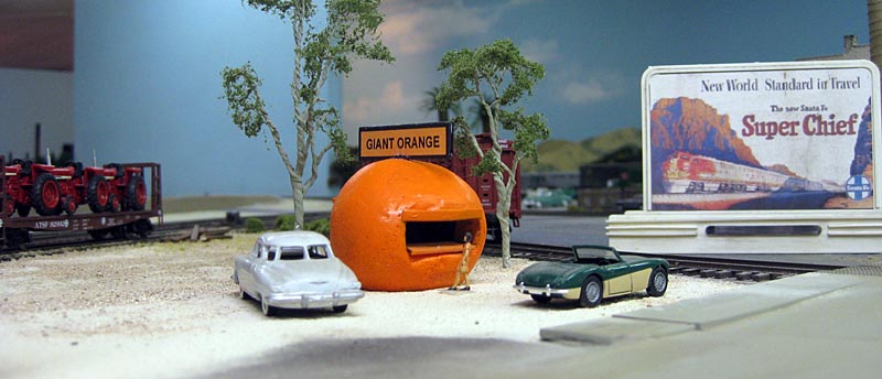 Figure
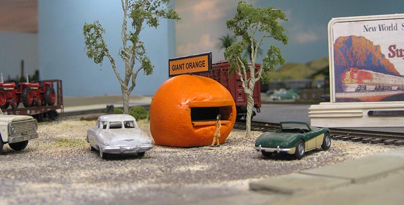
22. A Giant Orange stand serving fresh, cold orange juice has been
added to Arlington. For more on these orange stands, visit my California Orange Stands web page.
 Figure
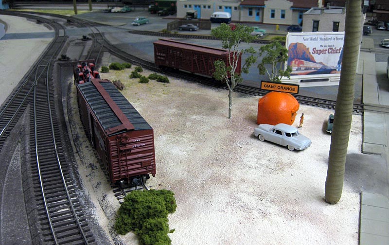
23. Overhead view of the open area around the Giant Orange stand. The track at the left with the boxcar and flat car is the Arlington team track.
Photos Added: July 5, 2010 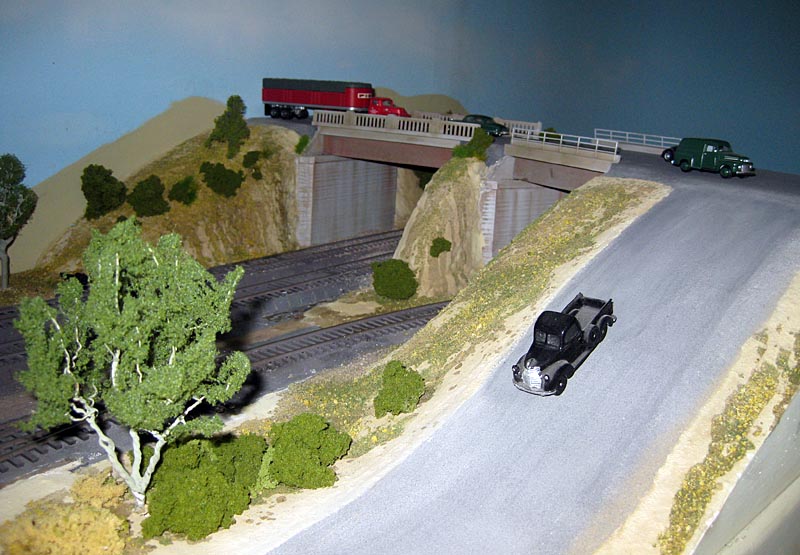 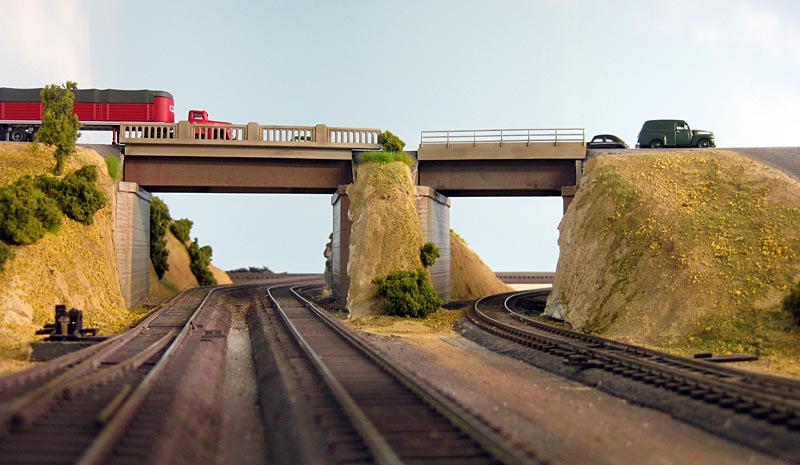 Figure
25. View of Barton Road looking north from track level. The double
track on the left is the Santa Fe Third District. The single
track on the right is the SP Riverside Branch.
 Figure
26. This is similar to Figure 22 but I thought the area around the
Giant Orange stand and along the team track needed some gravel.
Web page created 6/23/10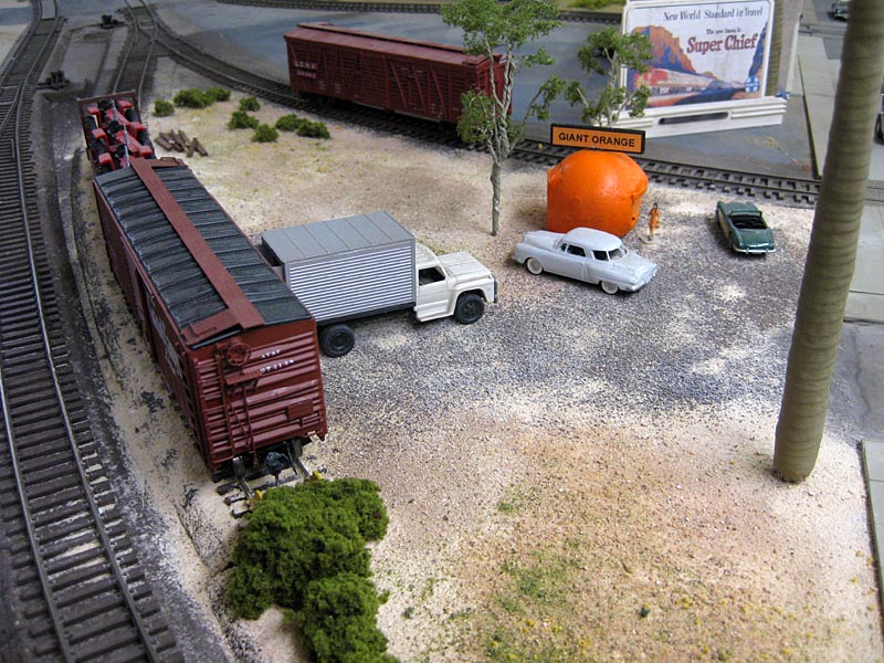 Last update: 7/5/10 |